T O P O G R A P H I C M A P S
CHILLIWACK, BRITISH COLUMBIA
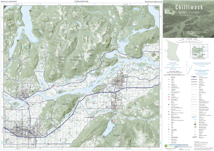
Created in ArcMap 9.3.1, hillshade and vegetation layer once exported from ArcMap were assembled and enhanced in CorelPHOTO-PAINT X4.
This term long project was modelled to reflect the process a real job would require.
An explanation of this project would be lengthy; the detailed supporting documents outline the term long process and specifications.
WON: BEST MAJOR TOPOGRAPHIC PROJECT IN CARTOGRAPHY AWARD 04/30/2010
BANFF NATIONAL PARK, ALBERTA
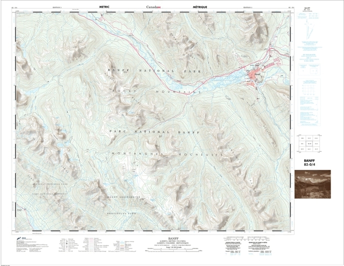
Created in Bentley Map V8 XM
This map was assigned as a final project in Advanced CAD Graphics - as the amount of data prevented a single file from being able to cope, it was divided among several files which were individually symbolized and referenced to each other. Initially these files were created from 2d and 3d seed files that were equipped with customized colour tables and cell libraries (these had been fashioned in previous assignments). Interoperability was used extensively to process shp files for import. In the Interoperability dialogue a New Import was created and a directory attached. The files were sorted by type and then individually assigned specifications before being imported. Mapped names were given, colours chosen, text styles assigned and cells identified. Once this process was complete, the files were imported into dgns created from the 2d seed file. Data was broken up in this way:
• Text and line elements • Surround
• Polygons (area features) • Hillshade
• Points • Grid and graticule
• all of these files were then referenced along with necessary rasters to a final Plot .dgn
In some cases symbology did not carry over correctly and theme files had to be made and reassigned in the Plot file. The project was plotted at 1:50 000 and was designed to emulate the style of NRCan's topographic series.
WON: BENTLEY AWARD - FOR HIGHEST MARK IN ADVANCED CAD GRAPHICS COURSE USING MICROSTATION 04/30/2010
HALIFAX HARBOUR NAUTICAL CHART
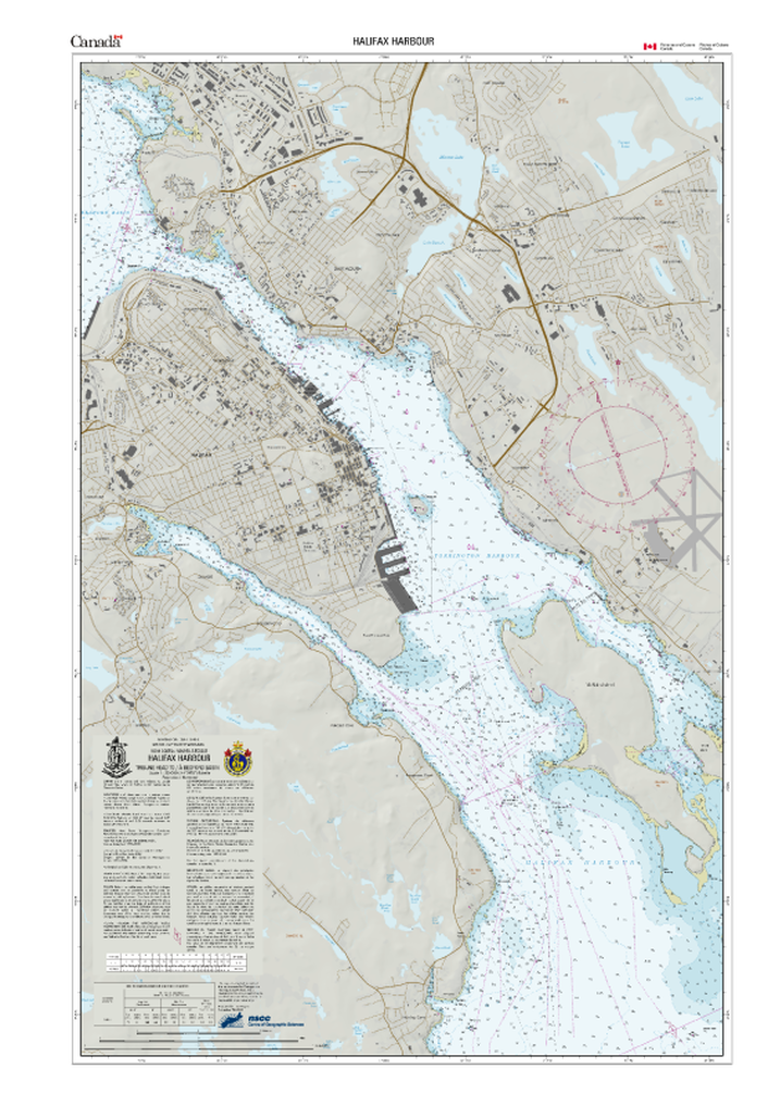
Created in ArcMap 9.3.1 and ArcCatalog
Chart was created by using 4 different geodatabases that were appended into the final study area.
CA576001.000 - 4201 – BEDFORD BASIN
CA576003.000 - 4202 - HALIFAX HARBOUR
CA576004.000 - 4202I - OCEAN TERMINALS INSET
CA576002.000 - 4203 - HALIFAX HARBOUR APPROACHES
The appended extent was then appropriately labeled, coloured and symbolized using IHO and CHS symbols as a reference.
ACADIA UNIVERSITY ORIENTEERING MAP
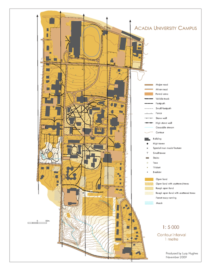
Created in OCAD 8.
[Information on OCAD can be found on their website OCAD - Smart for Cartography]
Orienteering maps are large scale topographic maps that serve a very specific purpose. The sport involves navigating between specific features in a given area with map and compass. (More information about Orienteering can be obtained by looking at Orienteering: The Enigmatic Sport of Navigation )
This was produced from a previous map I made using CorelDRAW in 2009. It was made for an event held at a CCA (Canadian Cartographic Association) conference in June 2009. This map was brought into OCAD as a template where it was used as a reference to re create a digital version for course setting.
