|
I was very fortunate to be a cartographer and member of the team that produced this paper map while working at The Atlas of Canada. Made using ArcMap 10.0, Adobe Photoshop CS4, CorelDRAW X4, Adobe Illustrator, Helvetica Neue Primarily, I: ¤ QC’d and applied corrections to data in Province of Nunavut ¤ QC’d and implemented corrections to protected areas and parks layer ¤ cleaned up, organized, and classified attributes for all annotation: provided query capability, which aided in application of type style and text placement ¤ edited annotation to make usable in Arc 10.0: had previously been in the form of coverages and needed substantial correction to appropriately place text ¤ selected typeface in consultation with head cartographer; chose text styles and sizes, then applied the style to all annotation ¤ placed the map's annotation, referencing 1:1,000,000 rivers, large hydrographic features, and topographic delineations; the Geographical Names of Canada database; and input from project researcher ¤ created graphic objects in CorelDRAW for import into .mxd to solve tight text placement issues |
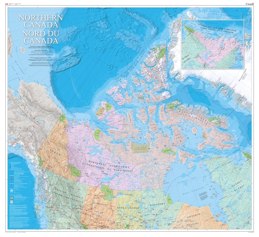
¤ updated, drew, and chose symbology for shipping lanes ¤ chose symbology for mines, created petroleum point symbol in CorelDRAW, exported as a true type font for use in Arc 10.0 ¤ attended weekly project and design meetings, provided input, participated in quality control and decision-making |
P L E A S E S E E T H E F I N A L P R O D U C T A L O N G W I T H A L L A C C O M P A N Y I N G I N F O R M A T I O N O N T H E A T L A S 'S W A L L M A P P A G E
Map published 31st March, 2012 - Natural Resources Canada
Map published 31st March, 2012 - Natural Resources Canada
