T H E M A T I C M A P S
ORIENTEERING: THE ENIGMATIC SPORT of NAVIGATION
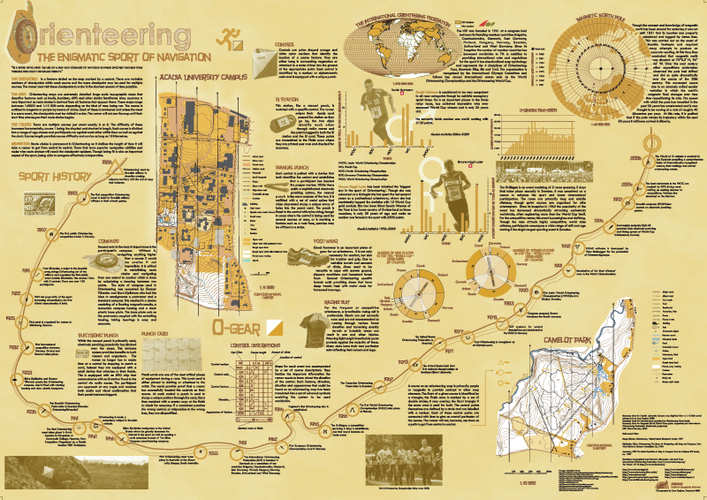
Created in OCAD map V8, ArcMap 9.3.1, CorelPHOTO-PAINT X4 and CorelDRAW X4.
The main aim of this mapping project was to describe and display maps specific to the sport of Orienteering.
A descriptive element was also necessary to explain the motives and basic aspects of the sport as it is largely unknown in North America. This background is designed to inform and educate the reader as well as tie the maps and theory together.
WON: HONORABLE MENTION - 2009-2010 AAG/NAIONAL GEOGRAPHIC AWARD IN MAPPING
http://www.natgeomaps.com/mapawards.html
PROPERTY ASSESSMENT VALUE 2007-2008, DIGBY, NS
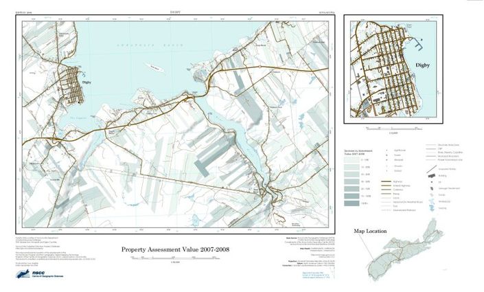
Created in ArcMap 9.2
WEIGHTED DRAINAGE, DIGBY, NS
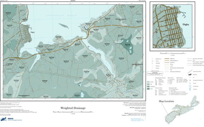
Created in ArcMap 9.2
SOIL NAME AND TEXTURE, DIGBY, NS
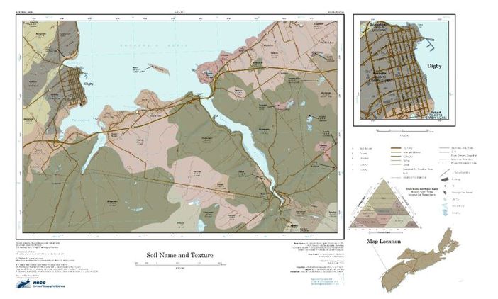
Created in ArcMap 9.2
SLOPE, DIGBY,NS

Created in ArcMap 9.2
FOREST TYPE AND MATURITY CLASS, DIGBY, NS
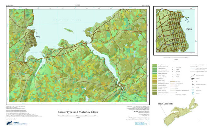
Created in ArcMap 9.2
SERVICE ANALYSIS NETWORK: GREENWICH FIRE STATION
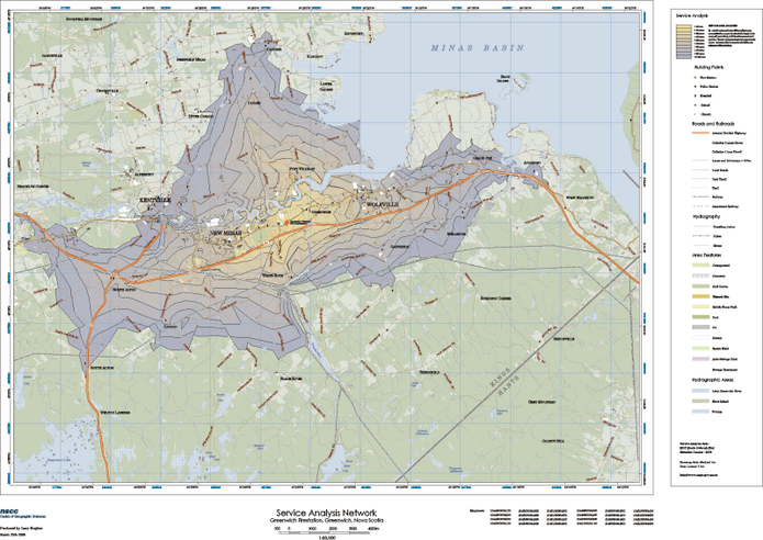
Created in ArcMap 9.2, symbology edited in CorelDRAW X4
This network depicts the time in minutes it would take a fire truck to respond to a call. This analysis is based on the road network, surface quality and the speed limits associated with them.
COLDBROOK LANDUSE, NS
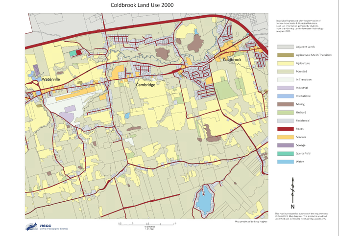
Created in AutoCAD Map 3D 2008
This map shows the zoning of land parcels in Coldbrook, Nova Scotia.
