A T L A S E S
BRIDGETOWN TREE ATLAS

Created in ArcMap 9.3.1 and CorelDRAW X4
This project was an introduction to the layout and assembly of an atlas. It incorporates information necessary to interpret tree species, gives statistics, shows a plan view of what further tree planting could achieve and provides plates of the town showing the geographic location of the species identified.
This project was an introduction to the layout and assembly of an atlas. It incorporates information necessary to interpret tree species, gives statistics, shows a plan view of what further tree planting could achieve and provides plates of the town showing the geographic location of the species identified.
NOVA SCOTIA STATISTICAL ATLAS
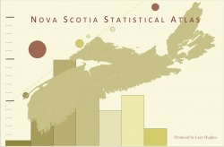
Created in ArcMap 9.3.1 and Adobe Illustrator CS3 (using MaPublisher)
This atlas depicts a variety of statistics for the province of Nova Scotia including:
population
projected population change
owned and rented housing
professional occupations in pure and applied science
This atlas depicts a variety of statistics for the province of Nova Scotia including:
population
projected population change
owned and rented housing
professional occupations in pure and applied science
OCEANIC MAPPING OF THE BLACK SEA
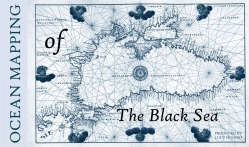
Created in ArcMap 9.3.1.
The subject of this atlas: The comparative change year over year for average temperature and salinity in the Black Sea between the years 1989 and 1992.
For information regarding the process of ocean mapping please see Ocean Mapping.
The subject of this atlas: The comparative change year over year for average temperature and salinity in the Black Sea between the years 1989 and 1992.
For information regarding the process of ocean mapping please see Ocean Mapping.
