A P P L I E D G I S
Topics, methods and subjects learned:
topo to raster tools
filling sinks
map algebra applications
junctions and edges
subtypes
connectivity rules
validating features
building geometric networks
- grid modelling
topo to raster tools
filling sinks
map algebra applications
- spatial analyst/raster calculator functions
- networking example here
junctions and edges
subtypes
connectivity rules
validating features
building geometric networks
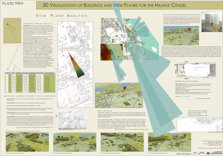
- working with lidar data
- creating viewplanes
- introduction to ArcScene
- processing hits using command line
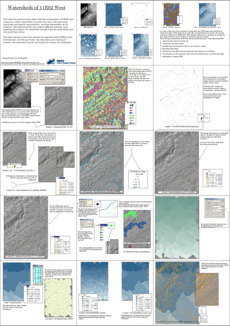
WATERSHED ANALYSIS
Created in ArcMap 9.3.1, ArcCatalog, Command prompt and CorelDRAW X4.
Documented process of watershed creation.
LIDAR 1 - DEPICTING HALIFAX CITADEL VIEWPLANES
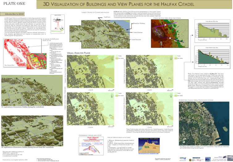
Created in ArcMap 9.3.1, ArcCatalog, Command prompt and CorelDRAW X4.
LIDAR 2
Created in ArcMap 9.3.1, ArcCatalog, Command prompt and CorelDRAW X4
